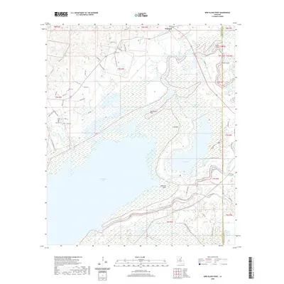
2020 Map of Bird Island Point
USGS Topo · Published 2020About this map
Catahoula Lake dominates the central landscape of this Louisiana quadrangle, where the expansive wetlands of LaSalle Parish meet the serpentine path of the Little River. The settlement of Whitehall sits in the north, serving as a gateway to a region defined by its intricate hydrography, including Big Bushley Creek and the meandering French Fork Little River. The geography is shaped by the shifting boundaries of water and land, notable at points like Bird Island Point and Mosquito Bend.
Find a feature on this map
78 named features on this map. Tap any name to fly to it.
Don’t see what you’re looking for? This feature index may not catch every label — zoom into the map to look around manually.
Map Details
Editions of this 2020 Bird Island Point Map
This is the sole edition of this map. No revisions or reprints were ever made.
Other maps of this area

1935 · Tooleys
USGS Topo · 1:62,500

1941 · Manifest
USGS Topo · 1:62,500

1941 · Jena
USGS Topo · 1:62,500

1941 · Buckeye
USGS Topo · 1:62,500

1941 · Tooleys
USGS Topo · 1:62,500

1953 · Alexandria
USGS Topo · 1:250,000

1953 · Natchez
USGS Topo · 1:250,000

1955 · Alexandria
USGS Topo · 1:250,000

1956 · Natchez
USGS Topo · 1:250,000

1958 · Jena
USGS Topo · 1:62,500