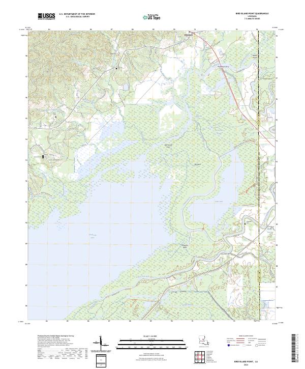
2024 Map of Bird Island Point
USGS Topo · Published 2024About this map
Rhineharts Ferry marks a historic crossing point on the Little River, a waterway that defines the intricate boundary between LaSalle and Catahoula Parishes. This landscape is a complex intersection of riverine systems and expansive wetlands, dominated by the Catahoula National Wildlife Refuge. The map reveals the seasonal nature of the terrain, where Catahoula Lake gives way to a network of named sloughs and bayous like Little Lake Slough and Muddy Bayou.
Find a feature on this map
75 named features on this map. Tap any name to fly to it.
Don’t see what you’re looking for? This feature index may not catch every label — zoom into the map to look around manually.
Map Details
Editions of this 2024 Bird Island Point Map
This is the sole edition of this map. No revisions or reprints were ever made.
Other maps of this area

1935 · Tooleys
USGS Topo · 1:62,500

1941 · Manifest
USGS Topo · 1:62,500

1941 · Jena
USGS Topo · 1:62,500

1941 · Buckeye
USGS Topo · 1:62,500

1941 · Tooleys
USGS Topo · 1:62,500

1953 · Alexandria
USGS Topo · 1:250,000

1953 · Natchez
USGS Topo · 1:250,000

1955 · Alexandria
USGS Topo · 1:250,000

1956 · Natchez
USGS Topo · 1:250,000

1958 · Jena
USGS Topo · 1:62,500