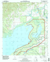
1994 Map of Bird Island Point
USGS Topo · Published 1997About this map
Catahoula Lake dominates the southwestern portion of this Louisiana landscape, its shoreline defined by a complex network of levees and bayous that manage the regional water table. The 1990s environment here is heavily shaped by conservation and flood control, with the Little Catahoula National Wildlife Refuge and the Saline State Wildlife Management Area protecting large swaths of wetland. The map illustrates a transition between the open waters of the lake and the dense, braided watercourses like Cowpen Bayou, French Bayou, and the Little River.
Find a feature on this map
43 named features on this map. Tap any name to fly to it.
Don’t see what you’re looking for? This feature index may not catch every label — zoom into the map to look around manually.
Map Details
Editions of this 1994 Bird Island Point Map
This is the sole edition of this map. No revisions or reprints were ever made.
Other maps of this area

1935 · Tooleys
USGS Topo · 1:62,500

1941 · Manifest
USGS Topo · 1:62,500

1941 · Jena
USGS Topo · 1:62,500

1941 · Buckeye
USGS Topo · 1:62,500

1941 · Tooleys
USGS Topo · 1:62,500

1953 · Alexandria
USGS Topo · 1:250,000

1953 · Natchez
USGS Topo · 1:250,000

1955 · Alexandria
USGS Topo · 1:250,000

1956 · Natchez
USGS Topo · 1:250,000

1958 · Jena
USGS Topo · 1:62,500