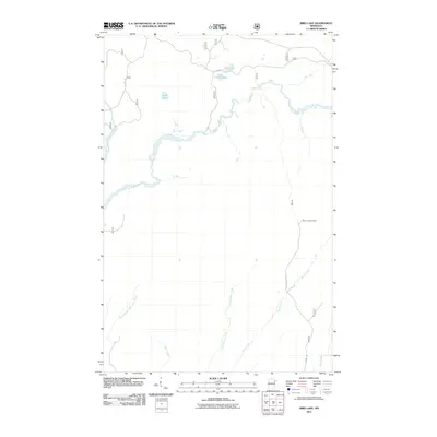
2011 Map of Bird Lake
USGS Topo · Published 2011About this map
The Saint Louis River winds through this northern landscape, forming a central hydrologic corridor that defines the drainage patterns of Saint Louis County. This 2011 survey reveals a territory dominated by water and forest management, where the Skibo Lookout Tower stands as a primary landmark for regional observation. Reached by Skibo Lookout Rd, this site overlooks a network of smaller water bodies such as Bird Lake, Little Lillian Lake, and Hush Lake. The terrain is deeply etched by numerous tributaries, including Shiver Creek and its companion Little Shiver Creek, as well as the uniquely named Bum Creek and South Branch Water Hen Creek. These waterways and the presence of Co Hwy 110 illustrate the typical intersection of industrial forestry access and the natural hydrology of the Arrowhead Region.
Find a feature on this map
24 named features on this map. Tap any name to fly to it.
Don’t see what you’re looking for? This feature index may not catch every label — zoom into the map to look around manually.
Map Details
Editions of this 2011 Bird Lake Map
This is the sole edition of this map. No revisions or reprints were ever made.
Other maps of this area

1949 · Aurora
USGS Topo · 1:24,000

1949 · Allen
USGS Topo · 1:24,000

1950 · Allen
USGS Topo · 1:24,000

1950 · Aurora
USGS Topo · 1:24,000

1951 · Babbitt SW
USGS Topo · 1:24,000

1954 · Two Harbors
USGS Topo · 1:250,000

1954 · Hibbing
USGS Topo · 1:250,000

1957 · Two Harbors
USGS Topo · 1:250,000

1957 · Hibbing
USGS Topo · 1:250,000

1957 · Brimson
USGS Topo · 1:62,500