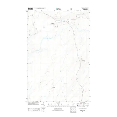
2013 Map of Bird Lake
USGS Topo · Published 2013About this map
The Saint Louis River snakes through this portion of the Superior National Forest, defining a landscape dominated by wetlands and glacial water bodies. This 2013 survey documents a predominantly undeveloped wilderness area where hydrology dictates the movement of people and wildlife. To the east, the Skibo Lookout Tower stands as a significant landmark for forest management and fire observation, overlooking a network of named drainages including Shiver Cr and Little Shiver Cr. Small, isolated lakes like Bird Lake, Little Lillian Lake, and Hush Lake are accessible only by forest roads such as Co HWY 110 and Forest Rte 190, which cut through the dense timber of Saint Louis County.
Find a feature on this map
14 named features on this map. Tap any name to fly to it.
Don’t see what you’re looking for? This feature index may not catch every label — zoom into the map to look around manually.
Map Details
Editions of this 2013 Bird Lake Map
This is the sole edition of this map. No revisions or reprints were ever made.
Other maps of this area

1949 · Aurora
USGS Topo · 1:24,000

1949 · Allen
USGS Topo · 1:24,000

1950 · Allen
USGS Topo · 1:24,000

1950 · Aurora
USGS Topo · 1:24,000

1951 · Babbitt SW
USGS Topo · 1:24,000

1954 · Two Harbors
USGS Topo · 1:250,000

1954 · Hibbing
USGS Topo · 1:250,000

1957 · Two Harbors
USGS Topo · 1:250,000

1957 · Hibbing
USGS Topo · 1:250,000

1957 · Brimson
USGS Topo · 1:62,500