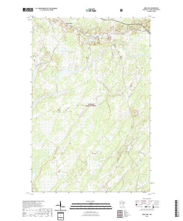
2022 Map of Bird Lake
USGS Topo · Published 2022About this map
Superior National Forest defines the character of this northern landscape, dominated by a complex network of wetlands and small glacial lakes. Near the settlement of Hoyt Lakes, the terrain transitions into a dense web of forestry and recreational trails including the Pequaywan Trl and Seven Beavers Trl. The upper reaches of the St Louis River and its various tributaries like Shiver Cr and Bum Cr highlight the hydrologic importance of this region.
Find a feature on this map
42 named features on this map. Tap any name to fly to it.
Don’t see what you’re looking for? This feature index may not catch every label — zoom into the map to look around manually.
Map Details
Editions of this 2022 Bird Lake Map
This is the sole edition of this map. No revisions or reprints were ever made.
Other maps of this area

1949 · Aurora
USGS Topo · 1:24,000

1949 · Allen
USGS Topo · 1:24,000

1950 · Allen
USGS Topo · 1:24,000

1950 · Aurora
USGS Topo · 1:24,000

1951 · Babbitt SW
USGS Topo · 1:24,000

1954 · Two Harbors
USGS Topo · 1:250,000

1954 · Hibbing
USGS Topo · 1:250,000

1957 · Two Harbors
USGS Topo · 1:250,000

1957 · Hibbing
USGS Topo · 1:250,000

1957 · Brimson
USGS Topo · 1:62,500