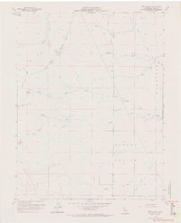
1959 Map of Bird Valley
USGS Topo · Published 1970About this map
Bird Valley and the surrounding Dunnigan Hills define this Yolo County landscape, where the seasonal drainage patterns of the North Fork, Middle Fork, and South Fork converge. The topography transition from the higher elevations of the Capay Hills in the west, marked by Bald Mtn, down into the broad agricultural expanse of Hungry Hollow. This area shows a sparse settlement pattern characteristic of mid-century California ranching and dry-farming, with scattered nodes like Buckhorn Camp and Goodnow providing central points in an otherwise open terrain.
Find a feature on this map
39 named features on this map. Tap any name to fly to it.
Don’t see what you’re looking for? This feature index may not catch every label — zoom into the map to look around manually.
Map Details
Editions of this 1959 Bird Valley Map
4 editions found
Other maps of this area

1905 · Harrington
USGS Topo · 1:24,000

1905 · Esparto
USGS Topo · 1:24,000

1907 · Dunnigan
USGS Topo · 1:62,500

1907 · Woodland
USGS Topo · 1:62,500

1916 · Jacobs Corner
USGS Topo · 1:31,680

1916 · Harrington
USGS Topo · 1:31,680

1916 · Hershey
USGS Topo · 1:31,680

1916 · Zamora
USGS Topo · 1:31,680

1916 · Esparto
USGS Topo · 1:31,680

1924 · Capay
USGS Topo · 1:62,500