
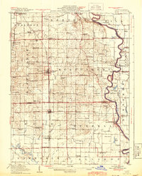
1917 Map of Birds
USGS Topo · Published 1917About this map
The Wabash River forms the eastern boundary of this 1917 map, carving a winding path through the borderlands of Illinois and Indiana. The river economy of the early twentieth century is evident in transit points like Brightlight Ferry and Shaws Landing, which provided essential crossings before modern infrastructure. Inland, the landscape is defined by the Chicago and St Louis R R and Cincinnati and Cleveland R R, rail lines that supported agricultural hubs like Flat Rock and Pinkstaff.
Find a feature on this map
83 named features on this map. Tap any name to fly to it.
Don’t see what you’re looking for? This feature index may not catch every label — zoom into the map to look around manually.
Map Details
Editions of this 1917 Birds Map
2 editions found
Other maps of this area

1910 · Hardinville
USGS Topo · 1:62,500

1911 · Sumner
USGS Topo · 1:62,500

1913 · Sumner
USGS Topo · 1:62,500

1915 · Vincennes
USGS Topo · 1:62,500

1942 · Fritchton
USGS Topo · 1:24,000

1942 · Birds
USGS Topo · 1:62,500

1943 · Merom
USGS Topo · 1:24,000

1943 · Carlisle
USGS Topo · 1:24,000

1943 · Oaktown
USGS Topo · 1:24,000

1943 · Sullivan
USGS Topo · 1:24,000