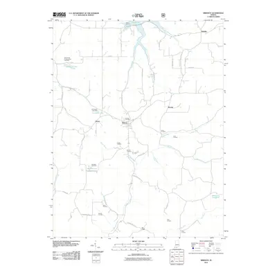
2010 Map of Birdseye
USGS Topo · Published 2010About this map
Birdseye serves as the central hub of this Southern Indiana landscape, where the Birdseye Post Office and nearby settlements of Mentor and Riceville are connected by a network of rural gravel roads and ridges. The terrain is defined by the winding course of the Anderson River and its numerous tributaries, including Waddle Brook and Mitchell Creek, which feed into various man-made reservoirs like Schnellville Lake and Carmichael Lake. Local genealogy is well-documented through a high concentration of family-named burial grounds, such as Adkins Cemetery near the shores of Patoka Lake and Taylor Cemetery tucked into Taylor Hollow. The map also illustrates the water management infrastructure of the era, noting several significant barriers such as the Schnellville Conservation Lake Dam and Idle Hour Lake Dam.
Find a feature on this map
59 named features on this map. Tap any name to fly to it.
Don’t see what you’re looking for? This feature index may not catch every label — zoom into the map to look around manually.
Map Details
Editions of this 2010 Birdseye Map
This is the sole edition of this map. No revisions or reprints were ever made.
Other maps of this area

1900 · St Meinrad
USGS Topo · 1:62,500

1903 · St. Meinrad
USGS Topo · 1:62,500

1954 · Dubois
USGS Topo · 1:24,000

1955 · Saint Anthony
USGS Topo · 1:24,000

1956 · Greenbrier
USGS Topo · 1:24,000

1956 · Taswell
USGS Topo · 1:24,000

1956 · Vincennes
USGS Topo · 1:250,000

1957 · Vincennes
USGS Topo · 1:250,000

1957 · Cuzco
USGS Topo · 1:24,000

1957 · Birdseye
USGS Topo · 1:24,000