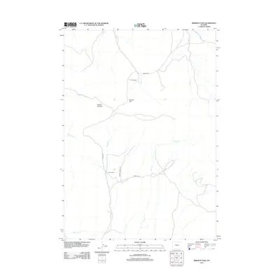
2012 Map of Birdseye Pass
USGS Topo · Published 2012About this map
Birdseye Pass serves as a central landmark in this high-altitude landscape of Fremont County, where drainage systems define the rugged geography. The area's ranching heritage is anchored by sites like Birdseye Ranch and Axtel Rnch, which are connected by a network of essential routes including Birdseye Rd and Copper Mountain Rd. Waterways such as Grass Cr, Jones Cr, and Tough Cr carve through the terrain, illustrating the critical role of seasonal and permanent creeks in supporting the local livestock industry. The presence of Birdseye Mountain provides a prominent geological reference point for understanding the physical orientation of this region, which remains sparsely populated and dedicated to agricultural use. This survey documents the intersection of physical geography and high-country ranching life in the early 21st century.
Find a feature on this map
14 named features on this map. Tap any name to fly to it.
Don’t see what you’re looking for? This feature index may not catch every label — zoom into the map to look around manually.
Map Details
Editions of this 2012 Birdseye Pass Map
This is the sole edition of this map. No revisions or reprints were ever made.
Other maps of this area

1950 · Bonneville SW
USGS Topo · 1:24,000

1951 · Boysen
USGS Topo · 1:24,000

1951 · Birdseye Pass
USGS Topo · 1:24,000

1951 · Bonneville
USGS Topo · 1:24,000

1952 · Picard Ranch
USGS Topo · 1:24,000

1952 · Guffy Peak
USGS Topo · 1:24,000

1955 · Thermopolis
USGS Topo · 1:250,000

1955 · Arminto
USGS Topo · 1:250,000
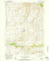
1957 · Bonneville
USGS Topo · 1:24,000

1958 · Thermopolis
USGS Topo · 1:250,000