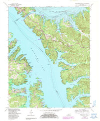
1967 Map of Birmingham Point
USGS Topo · Published 1988About this map
Land Between The Lakes dominates this mid-century survey, illustrating the dramatic hydrological landscape formed by the parallel courses of the Tennessee River and the Cumberland River. The creation of Kentucky Lake and Lake Barkley, linked by the Barkley Canal near Grand Rivers, fundamentally altered the geography of the peninsula. Local history is preserved in the location of the Birmingham Cem and the settlement of Birmingham near Buckhorn Creek, providing a record of the community's footprint before the waters rose.
Find a feature on this map
58 named features on this map. Tap any name to fly to it.
Don’t see what you’re looking for? This feature index may not catch every label — zoom into the map to look around manually.
Map Details
Editions of this 1967 Birmingham Point Map
3 editions found
Other maps of this area

1928 · Eddyville
USGS Topo · 1:48,000

1929 · Smithland
USGS Topo · 1:62,500

1931 · Eddyville
USGS Topo · 1:62,500

1936 · Eddyville
USGS Topo · 1:48,000

1936 · Mont
USGS Topo · 1:24,000

1936 · Fenton
USGS Topo · 1:24,000

1936 · Grand Rivers
USGS Topo · 1:24,000

1936 · Hardin
USGS Topo · 1:24,000

1936 · Smithland
USGS Topo · 1:48,000

1936 · Hiatt
USGS Topo · 1:24,000