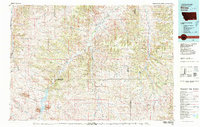
1980 Map of Birney
USGS Topo · Published 1980About this map
Large-scale resource extraction and rural settlement patterns define this section of Big Horn and Rosebud counties during the 1980s. The landscape is dominated by massive industrial footprints such as the Spring Creek Mine, West Decker Mine, and Tongue River Mine, signaling the era’s significant coal mining operations near the Wyoming border. These industrial sites contrast with the sparsely populated ranching and forest lands to the north, where small communities like Birney and Quietus persist alongside the Birney Day School.
Find a feature on this map
41 named features on this map. Tap any name to fly to it.
Don’t see what you’re looking for? This feature index may not catch every label — zoom into the map to look around manually.
Map Details
Editions of this 1980 Birney Map
This is the sole edition of this map. No revisions or reprints were ever made.
Other maps of this area

1894 · Rosebud
USGS Topo · 1:125,000

1895 · Dayton
USGS Topo · 1:125,000

1901 · Rosebud
USGS Topo · 1:125,000

1901 · Dayton
USGS Topo · 1:125,000

1909 · Sheridan
USGS Topo · 1:125,000

1911 · Sheridan
USGS Topo · 1:125,000

1954 · Hardin
USGS Topo · 1:250,000

1954 · Ekalaka
USGS Topo · 1:250,000

1954 · Gillette
USGS Topo · 1:250,000

1955 · Sheridan
USGS Topo · 1:250,000