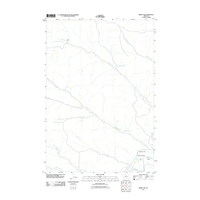
2011 Map of Birney SW
USGS Topo · Published 2011About this map
Prairie Dog Creek winds through the southeastern Montana landscape, leading toward its confluence with the Tongue River near the ranching lands of the Big Horn region. The area's agricultural and frontier character is evident in the presence of the Four D Ranch and the Four D Ditch, a water system supporting local activity on Ted Flat. These labels suggest a history of water management and livestock operations essential for survival in this semi-arid environment.
Find a feature on this map
21 named features on this map. Tap any name to fly to it.
Don’t see what you’re looking for? This feature index may not catch every label — zoom into the map to look around manually.
Map Details
Editions of this 2011 Birney SW Map
This is the sole edition of this map. No revisions or reprints were ever made.
Other maps of this area

1954 · Hardin
USGS Topo · 1:250,000

1957 · Hardin
USGS Topo · 1:250,000

1958 · Hardin
USGS Topo · 1:250,000

1958 · Bull Creek Lookout
USGS Topo · 1:24,000

1967 · Clubfoot Creek
USGS Topo · 1:24,000

1967 · Birney
USGS Topo · 1:24,000

1967 · Tongue River Dam
USGS Topo · 1:24,000
1967 · Cook Creek Butte
USGS Topo · 1:24,000

1967 · Lacey Gulch
USGS Topo · 1:24,000
1967 · Spring Gulch
USGS Topo · 1:24,000