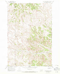
1967 Map of Cook Creek Butte
USGS Topo · Published 1971About this map
The Northern Cheyenne Indian Reservation landscape is defined by the high point of Cook Creek Butte and the cultural significance of the Buffalo Jump situated north of the main creek. This 1960s survey documents a highly dissected terrain where the Big Horn Co Rosebud Co boundary line traverses the drainage divides. Water sources are vital features here, from the branching flow of Cook Creek and Johns Fork Cook Creek to secluded points like St Johns Spring. The map captures the intricate network of coulees and ridges, such as Longjaw Coulee and Wild Hog Creek, reflecting a land-use pattern focused on high-elevation landmarks and reliable springs in a dry environment.
Find a feature on this map
14 named features on this map. Tap any name to fly to it.
Don’t see what you’re looking for? This feature index may not catch every label — zoom into the map to look around manually.
Map Details
Editions of this 1967 Cook Creek Butte Map
2 editions found
Other maps of this area

1954 · Hardin
USGS Topo · 1:250,000

1957 · Hardin
USGS Topo · 1:250,000

1958 · Hardin
USGS Topo · 1:250,000

1958 · Painted Hill
USGS Topo · 1:24,000

1958 · Bull Creek Lookout
USGS Topo · 1:24,000

1958 · Fisher Butte
USGS Topo · 1:24,000

1958 · Lame Deer
USGS Topo · 1:24,000

1967 · Clubfoot Creek
USGS Topo · 1:24,000

1967 · Birney
USGS Topo · 1:24,000
1967 · Taintor Desert
USGS Topo · 1:24,000