
1967 Map of Clubfoot Creek
USGS Topo · Published 1970About this map
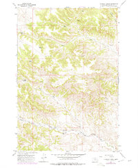
The Northern Cheyenne Indian Reservation Boundary runs through the southern reaches of this landscape, marking a significant cultural and administrative border in Rosebud County. This 1967 survey captures a remote ranching environment defined by the winding paths of Clubfoot Creek and the Black Eagle Fork. The settlement pattern is sparse, with the Morland Ranch situated along the lower valley of Cook Creek as it nears the Tongue River. The presence of numerous named water sources like Rondeau Spring, Elrot Spring, and B Heart Spring suggests the vital importance of groundwater for livestock and homesteading in this arid Montana terrain. The topography is dominated by the complex drainage systems of the Birney Creek and St Johns Fork, which carve through the high ridges to reach the river valley below.
Find a feature on this map
15 named features on this map. Tap any name to fly to it.
Don’t see what you’re looking for? This feature index may not catch every label — zoom into the map to look around manually.
Map Details
Editions of this 1967 Clubfoot Creek Map
2 editions found
Other maps of this area

1954 · Hardin
USGS Topo · 1:250,000

1957 · Hardin
USGS Topo · 1:250,000

1958 · Hardin
USGS Topo · 1:250,000

1958 · Fisher Butte
USGS Topo · 1:24,000

1958 · Lame Deer
USGS Topo · 1:24,000

1958 · Hollowwood Creek
USGS Topo · 1:24,000

1966 · Browns Mountain
USGS Topo · 1:24,000

1966 · Birney Day School
USGS Topo · 1:24,000

1967 · Birney
USGS Topo · 1:24,000
1967 · Cook Creek Butte
USGS Topo · 1:24,000