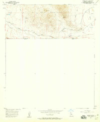
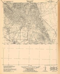
1958 Map of Bisbee SE
USGS Topo · Published 1959About this map
The Mule Mountains dominate this borderland landscape, where industrial mining and transcontinental rail infrastructure met the high desert in the late 1950s. The Southern Arizona mining legacy is visible through operations like the Glance Mine and Marquette Mine, alongside numerous unnamed prospects and a Shaft that dot the rugged terrain. Transportation was critical to this mineral economy, evidenced by the Southern Pacific tracks and an Old Railroad Grade that winds through the foothills.
Find a feature on this map
16 named features on this map. Tap any name to fly to it.
Don’t see what you’re looking for? This feature index may not catch every label — zoom into the map to look around manually.
Map Details
Editions of this 1958 Bisbee SE Map
3 editions found
Other maps of this area

1902 · Bisbee
USGS Topo · 1:62,500

1910 · Bisbee
USGS Topo · 1:62,500

1914 · Douglas
USGS Topo · 1:62,500

1916 · Douglas
USGS Topo · 1:125,000

1919 · Douglas
USGS Topo · 1:125,000

1925 · Douglas
USGS Topo · 1:62,500

1927 · Bisbee
USGS Topo · 1:62,500
1933 · Douglas
USGS Topo · 1:62,500
1933 · Bisbee
USGS Topo · 1:62,500

1955 · Douglas
USGS Topo · 1:250,000