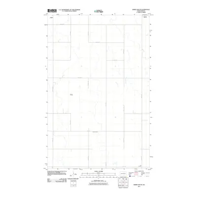
2011 Map of Bisbee South
USGS Topo · Published 2011About this map
The agricultural landscape of Towner County unfolds south of the town of Bisbee, where a precise grid of rural routes like 80th St NE and 57th Ave NE defines the prairie layout. This survey captures the region as a patchwork of small seasonal wetlands and drainage patterns, with the small community of Agate situated in the northwest corner. The map provides significant genealogical value through its inclusion of isolated family or community burial grounds, such as Teubner Cemetery and Halling Cemetery, which sit far from the primary towns. In the southeastern portion, Zion Cemetery is located along 75th St NE, marking a historical anchor point for the surrounding farmsteads in a region where few other landmarks break the horizon of the northern plains.
Find a feature on this map
18 named features on this map. Tap any name to fly to it.
Don’t see what you’re looking for? This feature index may not catch every label — zoom into the map to look around manually.
Map Details
Editions of this 2011 Bisbee South Map
This is the sole edition of this map. No revisions or reprints were ever made.
Other maps of this area

1953 · Devils Lake
USGS Topo · 1:250,000

1956 · Devils Lake
USGS Topo · 1:250,000

1971 · Bisbee South
USGS Topo · 1:24,000

1971 · Considine
USGS Topo · 1:24,000

1971 · Leeds NE
USGS Topo · 1:24,000

1971 · Mylo
USGS Topo · 1:24,000

1971 · Hurricane Lake West
USGS Topo · 1:24,000

1971 · Bisbee North
USGS Topo · 1:24,000
1971 · Big Coulee Dam
USGS Topo · 1:24,000

1971 · Mylo SE
USGS Topo · 1:24,000