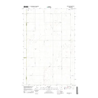
2014 Map of Bisbee South
USGS Topo · Published 2014About this map
Bisbee anchors the northeast corner of this prairie landscape, where the flat agricultural terrain is defined by a rigorous grid of section-line roads. This survey reveals a pattern of rural settlement characteristic of Towner County, where family legacies are preserved in small community burial grounds such as Teubner Cem and Halling Cem. The map captures the intersection of three counties—Towner, Pierce, and Rolette—illustrating how local governance and land management align with the cardinal directions of the Great Plains. Along the western edge, the small settlement of Agate sits near the Rolette County line, connected to the wider region by a network including Co Road 4805 and Bisbee Rd. Farther south, Zion Cem marks another historical focal point for the farming families who established this region's enduring rural character.
Find a feature on this map
24 named features on this map. Tap any name to fly to it.
Don’t see what you’re looking for? This feature index may not catch every label — zoom into the map to look around manually.
Map Details
Editions of this 2014 Bisbee South Map
This is the sole edition of this map. No revisions or reprints were ever made.
Other maps of this area

1953 · Devils Lake
USGS Topo · 1:250,000

1956 · Devils Lake
USGS Topo · 1:250,000

1971 · Bisbee South
USGS Topo · 1:24,000

1971 · Considine
USGS Topo · 1:24,000

1971 · Leeds NE
USGS Topo · 1:24,000

1971 · Mylo
USGS Topo · 1:24,000

1971 · Hurricane Lake West
USGS Topo · 1:24,000

1971 · Bisbee North
USGS Topo · 1:24,000
1971 · Big Coulee Dam
USGS Topo · 1:24,000

1971 · Mylo SE
USGS Topo · 1:24,000