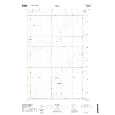
2020 Map of Bisbee South
USGS Topo · Published 2020About this map
Bisbee anchors the northeastern corner of this prairie landscape, where the rectangular grid of the Public Land Survey System defines the human geography. This region at the junction of Towner Co, Rolette Co, and Pierce Co is characterized by a dense network of sectional roads such as 54th Ave NE and 83rd St NE, which serve the agricultural interior. For genealogists, the map preserves the locations of several rural burial grounds, including Teubner Cem and Halling Cem, which are situated well away from established towns. Near the western edge, the small settlement of Agate remains a point of interest on the landscape. The অসংখ্য small wetlands and prairie potholes scattered across the survey area reveal the glacial history of this North Dakota terrain, influencing the placement of farms and cemeteries alike.
Find a feature on this map
26 named features on this map. Tap any name to fly to it.
Don’t see what you’re looking for? This feature index may not catch every label — zoom into the map to look around manually.
Map Details
Editions of this 2020 Bisbee South Map
This is the sole edition of this map. No revisions or reprints were ever made.
Other maps of this area

1953 · Devils Lake
USGS Topo · 1:250,000

1956 · Devils Lake
USGS Topo · 1:250,000

1971 · Bisbee South
USGS Topo · 1:24,000

1971 · Considine
USGS Topo · 1:24,000

1971 · Leeds NE
USGS Topo · 1:24,000

1971 · Mylo
USGS Topo · 1:24,000

1971 · Hurricane Lake West
USGS Topo · 1:24,000

1971 · Bisbee North
USGS Topo · 1:24,000
1971 · Big Coulee Dam
USGS Topo · 1:24,000

1971 · Mylo SE
USGS Topo · 1:24,000