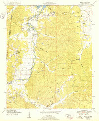
1951 Map of Bishop
USGS Topo · Published 1951About this map
Bear Creek meanders through the heart of the borderlands between Alabama and Mississippi, feeding into the Pickwick Reservoir during the mid-twentieth century. This map reveals a landscape defined by its deep hollows and narrow creek bottoms, where small communities like Allsboro and Maud served as local hubs. The presence of the Natchez Trace cutting through the western portion of the quadrangle highlights the area's deep connection to early transit routes, while the Alabama Wildlife Refuge indicates a commitment to land conservation in the east.
Find a feature on this map
58 named features on this map. Tap any name to fly to it.
Don’t see what you’re looking for? This feature index may not catch every label — zoom into the map to look around manually.
Map Details
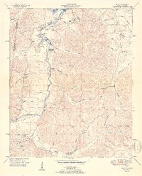
Editions of this 1951 Bishop Map
2 editions found
Other maps of this area

1911 · Iuka
USGS Topo · 1:48,000

1914 · Iuka
USGS Topo · 1:62,500

1924 · Gravelly Springs
USGS Topo · 1:48,000

1925 · Barton
USGS Topo · 1:62,500

1926 · Barton
USGS Topo · 1:48,000

1926 · Gravelly Springs
USGS Topo · 1:62,500

1929 · Barton
USGS Topo · 1:62,500

1935 · Cherokee
USGS Topo · 1:24,000

1935 · Iuka
USGS Topo · 1:24,000

1935 · Pleasant Site
USGS Topo · 1:24,000