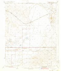
1947 Map of Bissell
USGS Topo · Published 1963About this map
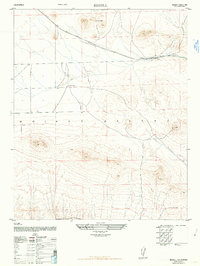
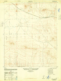
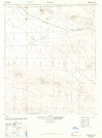
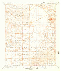
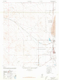
The Mojave Desert terrain of eastern Kern County dominates this 1947 survey, revealing a landscape defined by the logistics of the Atchison Topeka and Santa Fe railroad line. The settlement of Bissell sits as a vital point along these tracks, serving as a rare center of activity in a region of sparse habitation. Beyond the rail corridor, the map documents the presence of isolated desert outposts such as the De Stazo Ranch and the E Brown Ranch, highlighting the specialized ranching operations that persisted in this arid environment during the late 1940s.
Find a feature on this map
5 named features on this map. Tap any name to fly to it.
Don’t see what you’re looking for? This feature index may not catch every label — zoom into the map to look around manually.
Map Details
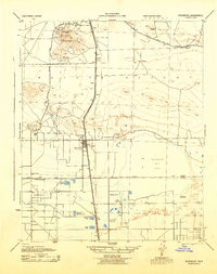
Editions of this 1947 Bissell Map
3 editions found
Other maps of this area

1915 · Elizabeth Lake
USGS Topo · 1:125,000

1915 · Searles Lake
USGS Topo · 1:250,000

1915 · Mojave
USGS Topo · 1:125,000

1917 · Elizabeth Lake
USGS Topo · 1:125,000
1937 · Rogers Lake
USGS Topo · 1:48,000
1942 · Rogers Lake
USGS Topo · 1:62,500
1943 · Rosamond
USGS Topo · 1:62,500
1943 · Castle Butte
USGS Topo · 1:62,500
1943 · Mojave
USGS Topo · 1:62,500
1947 · Fluhr
USGS Topo · 1:24,000