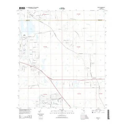
2015 Map of Bithlo
USGS Topo · Published 2015About this map
The community of Bithlo stands at the heart of this East Orange County landscape, where residential development transitions into the expansive wetlands of the St. Johns River basin. This 2015 survey details the eastern periphery of the Orlando metropolitan area, leading toward the rural settlement of Christmas. The terrain is defined by a dense network of hydrologic features, including the southward-flowing Tootoosahatchee Cr and the marshy edges of Puzzle Lake. Historic transit routes like Fort Christmas Rd anchor the local geography, connecting small residential clusters and providing access to the Christmas Cem. North of the Orange-Seminole county line, the map identifies Silcox Br and Mills Br, illustrating the intricate drainage patterns of the Central Florida lowlands during this period of continued suburban growth and environmental management.
Find a feature on this map
124 named features on this map. Tap any name to fly to it.
Don’t see what you’re looking for? This feature index may not catch every label — zoom into the map to look around manually.
Map Details
Editions of this 2015 Bithlo Map
This is the sole edition of this map. No revisions or reprints were ever made.
Other maps of this area

1950 · Aurantia
USGS Topo · 1:24,000

1953 · Narcoossee NE
USGS Topo · 1:24,000

1953 · Geneva
USGS Topo · 1:24,000

1953 · Titusville SW
USGS Topo · 1:24,000

1953 · Oviedo SW
USGS Topo · 1:24,000

1953 · Lake Poinsett NW
USGS Topo · 1:24,000

1953 · Narcoossee NW
USGS Topo · 1:24,000

1953 · Bithlo
USGS Topo · 1:24,000

1955 · Orlando
USGS Topo · 1:250,000

1956 · Oviedo
USGS Topo · 1:24,000