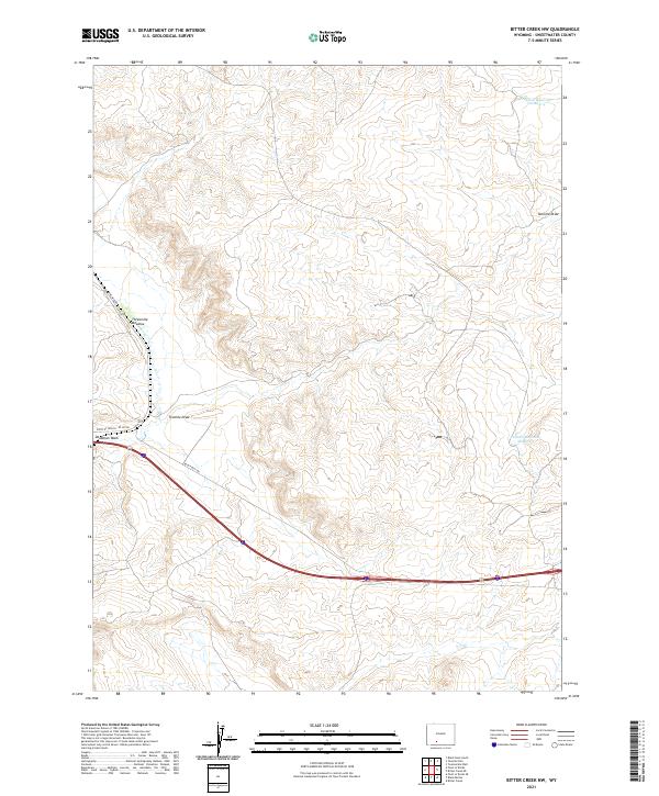
2021 Map of Bitter Creek NW
USGS Topo · Published 2021About this map
Tenmile Draw defines the central topography of this Sweetwater County landscape, where modern infrastructure meets a remote high-desert environment. This 2021 survey illustrates how water management shapes the arid terrain, featuring Tenmile Reservoir Number 4 and Tenmile Reservoir Number 3 alongside natural features like Threemile Meadow. The southern portion of the map is dominated by a major transportation corridor, including Interstate 80 and the Point of Rocks I-80 Svc Rd. These modern arteries follow the path of least resistance through the high country, crossing Deadman Wash and intersecting with established rural routes such as Black Bull Rd. The map provides a precise look at the Public Land Survey System grid, including the convergence of Township 20 North and Range 100 West.
Find a feature on this map
14 named features on this map. Tap any name to fly to it.
Don’t see what you’re looking for? This feature index may not catch every label — zoom into the map to look around manually.
Map Details
Editions of this 2021 Bitter Creek NW Map
This is the sole edition of this map. No revisions or reprints were ever made.
Other maps of this area

1954 · Rock Springs
USGS Topo · 1:250,000

1958 · Rock Springs
USGS Topo · 1:250,000

1958 · Twelvemile Well
USGS Topo · 1:62,500

1958 · Superior
USGS Topo · 1:62,500

1962 · Rock Springs
USGS Topo · 1:250,000

1968 · Bitter Creek NW
USGS Topo · 1:24,000

1968 · Bitter Creek
USGS Topo · 1:24,000

1968 · Black Buttes
USGS Topo · 1:24,000

1968 · Point Of Rocks
USGS Topo · 1:24,000
1968 · Point Of Rocks SE
USGS Topo · 1:24,000