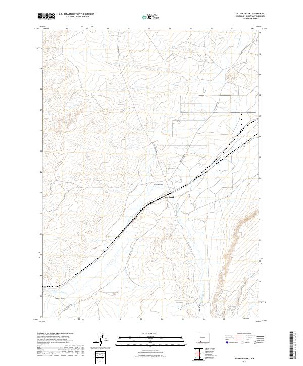
2021 Map of Bitter Creek
USGS Topo · Published 2021About this map
Bitter Creek serves as the focal point for this expansive stretch of the Wyoming high desert within the Great Divide Basin. The landscape is defined by the ephemeral drainage of Bitter Cr and the broad valley of Patrick Draw, where the intermittent flow of water has shaped the terrain over millennia. The area is characterized by a network of local transport routes, including Bitter Creek Rd and Patrick Draw Rd, which reflect the region's historical and ongoing importance for land management and resource access. Surveyed with precision, the map illustrates the systematic township and range organization typical of the American West, featuring boundaries like t18n r99w and t19n r99w. This particular sheet captures the quiet, utilitarian nature of the Sweetwater County backcountry, where modern county roads like Co Hwy 24 follow the natural contours of the drainages.
Find a feature on this map
12 named features on this map. Tap any name to fly to it.
Don’t see what you’re looking for? This feature index may not catch every label — zoom into the map to look around manually.
Map Details
Editions of this 2021 Bitter Creek Map
This is the sole edition of this map. No revisions or reprints were ever made.
Other maps of this area

1954 · Rock Springs
USGS Topo · 1:250,000

1958 · Rock Springs
USGS Topo · 1:250,000

1962 · Rock Springs
USGS Topo · 1:250,000

1968 · Bitter Creek NW
USGS Topo · 1:24,000

1968 · Sand Butte Rim NW
USGS Topo · 1:24,000

1968 · Bitter Creek
USGS Topo · 1:24,000

1968 · Black Buttes
USGS Topo · 1:24,000
1968 · Antelope Flats
USGS Topo · 1:24,000

1968 · Bitter Creek NE
USGS Topo · 1:24,000

1970 · Table Rock
USGS Topo · 1:24,000