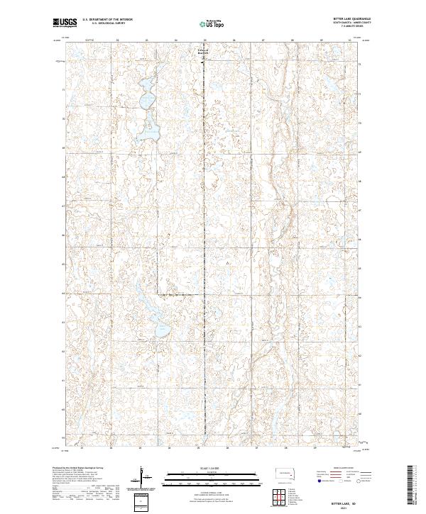
2021 Map of Bitter Lake
USGS Topo · Published 2021About this map
The Town of Roswell serves as the primary settlement in this corner of Miner County, situated near the northern edge of the map. This prairie landscape is defined by its distinct hydrography, characterized by numerous depressions and wetlands typical of the region's glaciated terrain. To the south of town lie the Twin Lakes, while the larger, irregularly shaped Bitter Lake dominates the central-west portion of the quadrangle. For genealogists and local historians, the Roswell Cem provides a specific point of interest just east of the main town site. The map also traces the winding courses of Pooley Cr and Rock Cr, which navigate the agricultural grid of numbered avenues and streets. The distribution of Burke Slough and other smaller water bodies illustrates the natural drainage patterns that have shaped land use and local development in this South Dakota township.
Find a feature on this map
25 named features on this map. Tap any name to fly to it.
Don’t see what you’re looking for? This feature index may not catch every label — zoom into the map to look around manually.
Map Details
Editions of this 2021 Bitter Lake Map
This is the sole edition of this map. No revisions or reprints were ever made.
Other maps of this area

1899 · Alexandria
USGS Topo · 1:125,000

1899 · De Smet
USGS Topo · 1:125,000

1953 · Watertown
USGS Topo · 1:250,000

1955 · Sioux Falls
USGS Topo · 1:250,000

1958 · Sioux Falls
USGS Topo · 1:250,000

1958 · Watertown
USGS Topo · 1:250,000

1971 · Fedora
USGS Topo · 1:24,000

1971 · Howard
USGS Topo · 1:24,000
1972 · Roswell
USGS Topo · 1:24,000
1973 · Morris Lake
USGS Topo · 1:24,000