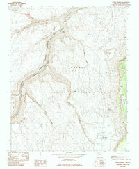
1985 Map of Bitter Springs
USGS Topo · Published 1985About this map
Marble Canyon and the Colorado River carve a deep physical boundary through this landscape, marking the transition between Grand Canyon National Park and the Navajo Indian Reservation. This mid-1980s survey captures a high-desert environment defined by extreme relief, where the steep rise of the Echo Cliffs looms over Little Valley to the east. Along the river, specialized navigation points like Soap Creek Rapids, Sheer Wall Rapids, and Browns Riffle indicate the treacherous nature of the watercourse. Settlement is concentrated at Bitter Springs, where a Landing Strip and the route of Highway 89 provide essential infrastructure. Indigenous place names and land features such as Lii'gan Dah Sizini and Hanna Nimadzidzahi Wash reveal the cultural geography of the Navajo lands that occupy the eastern half of the map.
Find a feature on this map
32 named features on this map. Tap any name to fly to it.
Don’t see what you’re looking for? This feature index may not catch every label — zoom into the map to look around manually.
Map Details
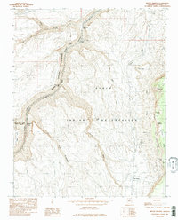
Editions of this 1985 Bitter Springs Map
2 editions found
Other maps of this area

1886 · Echo Cliffs
USGS Topo · 1:250,000

1891 · Echo Cliffs
USGS Topo · 1:250,000

1954 · Emmett Wash NE
USGS Topo · 1:24,000

1954 · Paria Plateau SE
USGS Topo · 1:24,000

1954 · Lees Ferry SE
USGS Topo · 1:24,000

1954 · Lees Ferry SW
USGS Topo · 1:24,000

1954 · Tanner Wash
USGS Topo · 1:62,500

1954 · Emmett Wash
USGS Topo · 1:62,500

1954 · Lees Ferry
USGS Topo · 1:62,500
1954 · Paria Plateau
USGS Topo · 1:62,500