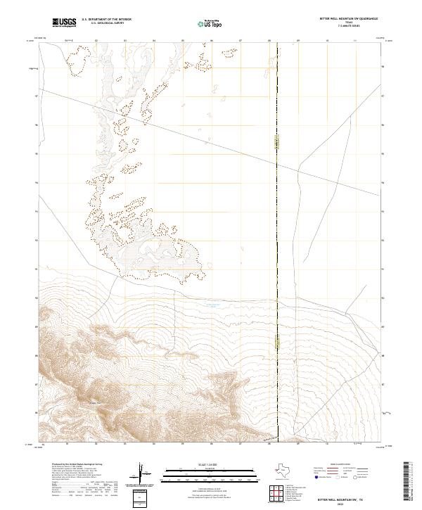
2022 Map of Bitter Well Mountain SW
USGS Topo · Published 2022About this map
The high-desert terrain of West Texas is defined here by the steep elevations of the Diablo Rim, where the land drops sharply toward the surrounding flats. This landscape, straddling the line between Hudspeth and Culberson counties, is marked by the scarce water resources essential for ranching and survival in the Trans-Pecos. The presence of the John Garner Tank illustrates the importance of managed water catchment in this arid environment. To the south, the terrain is carved by the deep Apache Canyon, revealing the rugged geological character of the region. This 2022 survey provides a clear view of the ranching infrastructure and natural drainages that remain the primary landmarks in this sparsely populated portion of the Salt Flat area.
Find a feature on this map
4 named features on this map. Tap any name to fly to it.
Don’t see what you’re looking for? This feature index may not catch every label — zoom into the map to look around manually.
Map Details
Editions of this 2022 Bitter Well Mountain SW Map
This is the sole edition of this map. No revisions or reprints were ever made.
Other maps of this area

1895 · Sierra Blanca
USGS Topo · 1:125,000

1906 · Van Horn
USGS Topo · 1:125,000

1954 · Van Horn
USGS Topo · 1:250,000

1955 · Black Mountains
USGS Topo · 1:62,500

1958 · Van Horn
USGS Topo · 1:250,000

1973 · Bitter Well Mountain NW
USGS Topo · 1:24,000

1973 · Bitter Well Mountain SW
USGS Topo · 1:24,000

1973 · Sneed Mountain NE
USGS Topo · 1:24,000

1973 · Apache Peak
USGS Topo · 1:24,000

1973 · Bitter Well Mountain
USGS Topo · 1:24,000