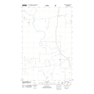
2011 Map of Biwabik NE
USGS Topo · Published 2011About this map
Pike River winds extensively through the landscape of northeastern Minnesota, anchoring a rural topography characterized by small settlements and historic burial grounds. The small community of Wahlsten sits in the north, while the intersection at Salo Corner marks a point of transit further south. These pockets of settlement are connected by a network of family-named roads like Nietala Rd and Lehto Rd, reflecting the Finnish heritage of Saint Louis County’s Iron Range region. Genealogists will find particular value in the documentation of three distinct burial sites: Vermilion Lake Cemetery, the Old Vermilion Lake Cemetery, and Embarrass Cemetery. The map also details the wetlands and water bodies of the Arrowhead region, including the Embarrass River, Lola Lake, and Lempia Lakes, illustrating the natural drainage patterns that have long dictated the placement of roads and homesteads.
Find a feature on this map
42 named features on this map. Tap any name to fly to it.
Don’t see what you’re looking for? This feature index may not catch every label — zoom into the map to look around manually.
Map Details
Editions of this 2011 Biwabik NE Map
This is the sole edition of this map. No revisions or reprints were ever made.
Other maps of this area

1949 · Aurora
USGS Topo · 1:24,000

1949 · Embarrass
USGS Topo · 1:24,000

1950 · Embarrass
USGS Topo · 1:24,000

1950 · Aurora
USGS Topo · 1:24,000

1950 · Biwabik
USGS Topo · 1:24,000

1950 · Mc Kinley
USGS Topo · 1:24,000

1950 · Biwabik NW
USGS Topo · 1:24,000

1950 · Biwabik NE
USGS Topo · 1:24,000

1951 · Biwabik
USGS Topo · 1:24,000

1951 · Mc Kinley
USGS Topo · 1:24,000