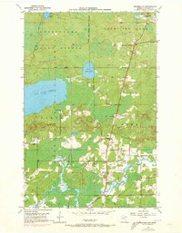
1950 Map of Biwabik NW
USGS Topo · Published 1973About this map
Big Rice Lake and the winding Pike River anchor this mid-century look at the northern woods of St. Louis County, where public lands converge at the State and National Forest Boundary. The map documents a landscape defined by state and federal forestry, split between the Kabetogama State Forest, Vermilion Lake State Forest, and the Superior National Forest.
Find a feature on this map
21 named features on this map. Tap any name to fly to it.
Don’t see what you’re looking for? This feature index may not catch every label — zoom into the map to look around manually.
Map Details
Editions of this 1950 Biwabik NW Map
5 editions found
Other maps of this area

1950 · Biwabik
USGS Topo · 1:24,000

1950 · Mc Kinley
USGS Topo · 1:24,000

1950 · Biwabik NW
USGS Topo · 1:24,000

1950 · Biwabik NE
USGS Topo · 1:24,000

1951 · Biwabik
USGS Topo · 1:24,000

1951 · Mc Kinley
USGS Topo · 1:24,000

1951 · Biwabik NE
USGS Topo · 1:24,000

1951 · Biwabik NW
USGS Topo · 1:24,000

1951 · Virginia
USGS Topo · 1:24,000

1951 · Britt
USGS Topo · 1:24,000