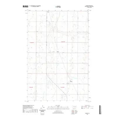
2020 Map of Blabon
USGS Topo · Published 2020About this map
Finley and the surrounding agricultural lands of Steele County are defined by the meandering course of the Maple River, which cuts a distinct path through the prairie landscape. This 2020 survey documents the rural character of the region, anchored by small settlements such as Pickert and Blabon. The layout of the land is strictly organized by township and range lines, including t146n r56w and t145n r57w, reflecting the enduring influence of the Public Land Survey System. Genealogical interest is centered on the local burial grounds, specifically Pickert Cem and Blabon Cem, which serve as permanent records of the area's pioneer families. Small water bodies like Lynch Lake dot the terrain, while a network of rural roads, including Co HWY 11 and 127th Ave Ne, connects the isolated farmsteads that characterize this part of North Dakota.
Find a feature on this map
20 named features on this map. Tap any name to fly to it.
Don’t see what you’re looking for? This feature index may not catch every label — zoom into the map to look around manually.
Map Details
Editions of this 2020 Blabon Map
This is the sole edition of this map. No revisions or reprints were ever made.
Other maps of this area

1952 · Grand Forks
USGS Topo · 1:250,000

1956 · Grand Forks
USGS Topo · 1:250,000

1966 · Grand Forks
USGS Topo · 1:250,000

1967 · Blabon
USGS Topo · 1:24,000

1967 · Finley
USGS Topo · 1:24,000
1967 · Luverne
USGS Topo · 1:24,000
1967 · Sharon
USGS Topo · 1:24,000
1967 · Luverne NW
USGS Topo · 1:24,000

1967 · Luverne SE
USGS Topo · 1:24,000

1968 · Sherbrooke
USGS Topo · 1:24,000