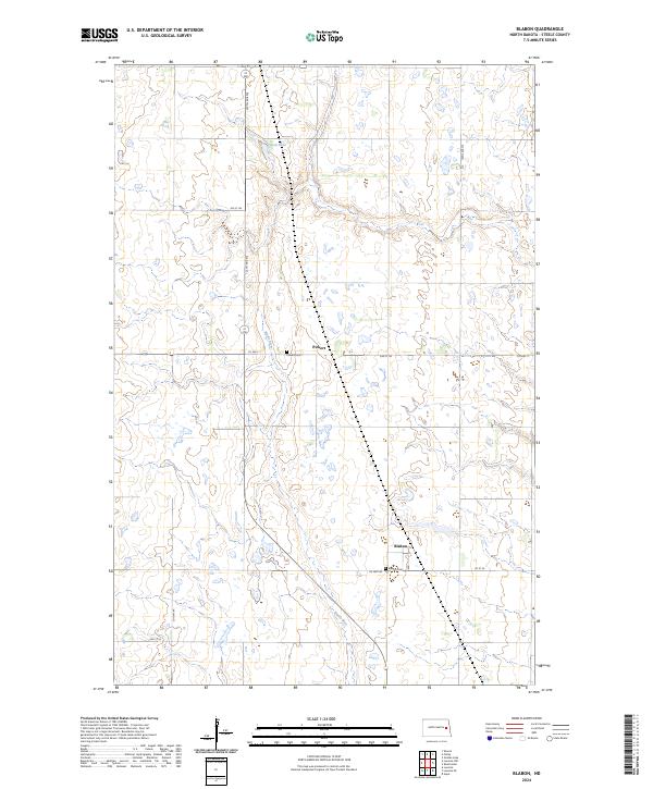
2024 Map of Blabon
USGS Topo · Published 2024About this map
The Maple River meanders through this portion of Steele County, carving a valley across the prairie landscape. The small settlement of Blabon sits at the intersection of Co Hwy 8A and 1st St SE, serving as a focal point for the surrounding agricultural community. Further north, the hamlet of Pickert is situated along Co Hwy 11. Both locations maintain local historical markers in the form of the Blabon Cem and Pickert Cem, which provide essential touchpoints for genealogical research in this rural region. The terrain is dotted with numerous small wetlands and depressions characteristic of the drift prairie, including Lynch Lake in the northern section. This survey illustrates the persistent grid of section lines and county roads, such as 127th Ave NE, that organize the North Dakota countryside.
Find a feature on this map
18 named features on this map. Tap any name to fly to it.
Don’t see what you’re looking for? This feature index may not catch every label — zoom into the map to look around manually.
Map Details
Editions of this 2024 Blabon Map
This is the sole edition of this map. No revisions or reprints were ever made.
Other maps of this area

1952 · Grand Forks
USGS Topo · 1:250,000

1956 · Grand Forks
USGS Topo · 1:250,000

1966 · Grand Forks
USGS Topo · 1:250,000

1967 · Blabon
USGS Topo · 1:24,000

1967 · Finley
USGS Topo · 1:24,000
1967 · Luverne
USGS Topo · 1:24,000
1967 · Sharon
USGS Topo · 1:24,000
1967 · Luverne NW
USGS Topo · 1:24,000

1967 · Luverne SE
USGS Topo · 1:24,000

1968 · Sherbrooke
USGS Topo · 1:24,000