1973 Map of Black Bay South
USGS Topo · Published 1976About this map
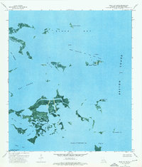
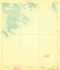
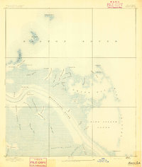
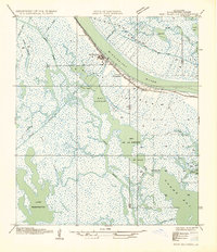
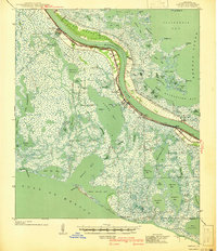
West Black Bay Oil and Gas Field dominates the marine environment of this 1970s coastal survey, illustrating the industrial footprint of offshore extraction in Plaquemines Parish. The orthophotomap imagery reveals a complex landscape of shifting marshland and open water where Black Bay meets Breton Sound. Isolated landforms such as Belle Isle, Stone Island, and Lonesome Island punctuate the aquatic expanse, serving as essential landmarks for navigation alongside numerous oil platforms and a Radio Tower. The southern portion of the map includes part of the Bohemia State Wildlife Management Area, highlighting the intersection of resource extraction and conservation. Intricate waterways like Bel La Pass and Bayou Lost demonstrate the fluid nature of the Louisiana shoreline before significant subsidence further altered these coastal reaches.
Find a feature on this map
20 named features on this map. Tap any name to fly to it.
Don’t see what you’re looking for? This feature index may not catch every label — zoom into the map to look around manually.
Map Details
Editions of this 1973 Black Bay South Map
2 editions found

Other maps of this area

1892 · Quarantine
USGS Topo · 1:62,500
1893 · La Fortuna
USGS Topo · 1:62,500
1893 · Forts
USGS Topo · 1:62,500

1893 · Dime
USGS Topo · 1:62,500
1935 · Port Sulphur
USGS Topo · 1:31,680

1935 · Lake Athanasio
USGS Topo · 1:31,680

1935 · Lake Calebasse
USGS Topo · 1:31,680

1935 · Tropical Bend
USGS Topo · 1:31,680

1941 · Black Bay
USGS Topo · 1:62,500
1941 · Empire
USGS Topo · 1:62,500