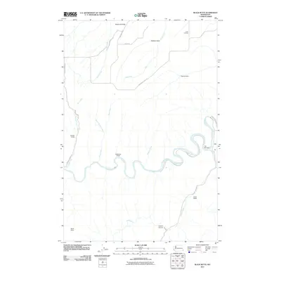
2011 Map of Black Butte
USGS Topo · Published 2011About this map
The Grande Ronde River carves a winding path through the canyonlands of Asotin County, defining the drainage patterns and transportation routes of this 2011 landscape. The river creates sharp meanders, notably at The Narrows, where the water snakes around steep promontories. To the south, the terrain deepens into Joseph Canyon, a significant geological feature formed by the confluence of Joseph Creek and the Grande Ronde.
Find a feature on this map
25 named features on this map. Tap any name to fly to it.
Don’t see what you’re looking for? This feature index may not catch every label — zoom into the map to look around manually.
Map Details
Editions of this 2011 Black Butte Map
This is the sole edition of this map. No revisions or reprints were ever made.
Other maps of this area

1944 · Anatone
USGS Topo · 1:62,500

1946 · Limekiln Rapids
USGS Topo · 1:62,500

1946 · Anatone
USGS Topo · 1:62,500

1955 · Pullman
USGS Topo · 1:250,000

1955 · Grangeville
USGS Topo · 1:250,000

1958 · Pullman
USGS Topo · 1:250,000

1959 · Grangeville
USGS Topo · 1:250,000

1963 · Jim Creek Butte
USGS Topo · 1:24,000
1967 · Paradise
USGS Topo · 1:24,000
1967 · Teepee Butte
USGS Topo · 1:24,000