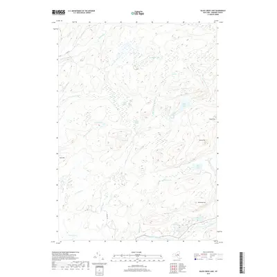
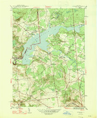
2019 Map of Black Creek Lake
USGS Topo · Published 2019About this map
West Canada Creek and the Black River define the hydraulic character of this Herkimer County landscape, where an intricate network of vlys, marshes, and glacial lakes dominates the terrain. The presence of numerous small water bodies such as Bullhead Pond, White Lead Lake, and the expansive Twin Lakes Marsh suggests a wilderness area characterized by significant wetlands and seasonal drainage patterns. High points like McCauley Mtn and Lawson Top provide the relief that separates these diverse watersheds. Human activity is represented by just a few corridors, notably N Lake Rd and Furlong Rd, which offer the primary access to these interior waters. The map is particularly useful for identifying minor landmarks like Wells Vly and Crosby Vly, which are critical for local history and geographic orientation in this remote Adirondack-fringe region.
Find a feature on this map
34 named features on this map. Tap any name to fly to it.
Don’t see what you’re looking for? This feature index may not catch every label — zoom into the map to look around manually.
Map Details
Editions of this 2019 Black Creek Lake Map
This is the sole edition of this map. No revisions or reprints were ever made.
Other maps of this area

1897 · Remsen
USGS Topo · 1:62,500

1900 · Remsen
USGS Topo · 1:62,500

1900 · Wilmurt
USGS Topo · 1:62,500

1901 · Old Forge
USGS Topo · 1:62,500

1902 · Wilmurt
USGS Topo · 1:62,500

1912 · Mc Keever
USGS Topo · 1:62,500
1946 · Hinckley
USGS Topo · 1:25,000
1946 · North Wilmurt
USGS Topo · 1:24,000
1947 · North Wilmurt
USGS Topo · 1:31,680
1947 · Hinckley
USGS Topo · 1:31,680