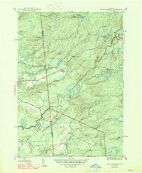
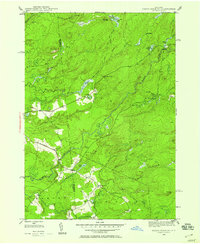
1947 Map of North Wilmurt
USGS Topo · Published 1947About this map
North Wilmurt and the surrounding wilderness of the southwestern Adirondacks appear here in a landscape defined by seasonal camps and early roads. The boundary between Herkimer Co and Oneida Co bisects a terrain of high ridges and winding waterways, where the Black River and Little Woodhull Creek drain the western slopes. Isolated settlements like Wheelertown and Enos are small focal points in a region largely dedicated to logging and sporting life, as evidenced by Stone Dam Lake Camp and Lyons Camp. Significant landmarks like Wheelertown Cem and the naming of local heights such as Finn Hill and Party Hill provide clear markers for genealogical research and local history. The road network, including Bellingertown Road, suggests the movement of goods and people between these remote mountain outposts and the larger valley towns to the south.
Find a feature on this map
37 named features on this map. Tap any name to fly to it.
Don’t see what you’re looking for? This feature index may not catch every label — zoom into the map to look around manually.
Map Details
Editions of this 1947 North Wilmurt Map
2 editions found
Other maps of this area

1897 · Remsen
USGS Topo · 1:62,500

1900 · Remsen
USGS Topo · 1:62,500

1900 · Wilmurt
USGS Topo · 1:62,500

1901 · Old Forge
USGS Topo · 1:62,500

1902 · Wilmurt
USGS Topo · 1:62,500

1912 · Mc Keever
USGS Topo · 1:62,500

1945 · Forestport
USGS Topo · 1:24,000
1946 · Hinckley
USGS Topo · 1:25,000
1946 · Remsen
USGS Topo · 1:31,680
1946 · North Wilmurt
USGS Topo · 1:24,000