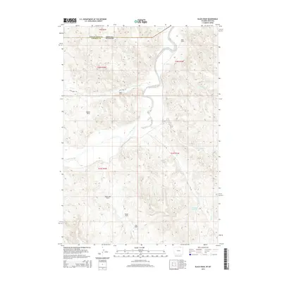
2015 Map of Black Draw
USGS Topo · Published 2015About this map
The Powder River carves a winding path through the borderlands of Wyoming and Montana, defining a landscape of high plains and deep drainage channels. This 2015 survey reveals the intricate network of watercourses and topographical basins that shape Campbell County, including Watson Basin and a series of named ravines like Black Draw and Water-Gap Draw. Small-scale ranching and water management are evident through features like Warren Reservoir and Greenough Reservoir, which anchor the sparse drainage of Williams Cr and LX Bar Cr. The map captures the remote character of the Powder River Basin just south of the state line, where infrastructure is limited to routes such as Fence Creek Rd and SA Rd. It serves as a precise record of the regional hydrology, from the northern Line Cr to the southern reaches of Coal Cr and Crooked Cr.
Find a feature on this map
29 named features on this map. Tap any name to fly to it.
Don’t see what you’re looking for? This feature index may not catch every label — zoom into the map to look around manually.
Map Details
Editions of this 2015 Black Draw Map
This is the sole edition of this map. No revisions or reprints were ever made.
Other maps of this area

1954 · Hardin
USGS Topo · 1:250,000

1954 · Ekalaka
USGS Topo · 1:250,000

1954 · Gillette
USGS Topo · 1:250,000

1955 · Sheridan
USGS Topo · 1:250,000

1955 · Gillette
USGS Topo · 1:250,000

1956 · Ekalaka
USGS Topo · 1:250,000

1957 · Hardin
USGS Topo · 1:250,000

1958 · Gillette
USGS Topo · 1:250,000

1958 · Ekalaka
USGS Topo · 1:250,000

1958 · Hardin
USGS Topo · 1:250,000