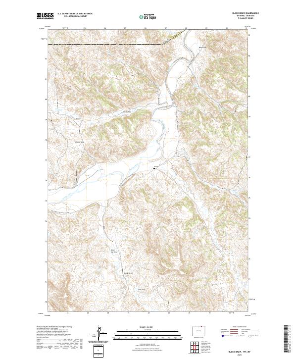
2021 Map of Black Draw
USGS Topo · Published 2021About this map
The Powder River winds through this section of the high plains along the border of Montana and Wyoming, carving a distinct valley through the arid landscape of Campbell County. This 2021 update of the terrain near Watson Basin highlights a remote network of ranch roads and seasonal drainages that define the local topography. Of particular interest to genealogists and local historians is the ER Cem, a small burial site situated near the Big Powder River Cut-Across Rd. The map detail captures the complex drainage patterns of named features like Dead Horse Cr and LX Bar Cr, reflecting the region's reliance on intermittent water sources. The landscape is characterized by numerous draws and gulches, such as Black Draw and Bear Gulch, which provide critical waypoints in a territory primarily organized by Section, Township, and Range lines.
Find a feature on this map
28 named features on this map. Tap any name to fly to it.
Don’t see what you’re looking for? This feature index may not catch every label — zoom into the map to look around manually.
Map Details
Editions of this 2021 Black Draw Map
This is the sole edition of this map. No revisions or reprints were ever made.
Other maps of this area

1954 · Hardin
USGS Topo · 1:250,000

1954 · Ekalaka
USGS Topo · 1:250,000

1954 · Gillette
USGS Topo · 1:250,000

1955 · Sheridan
USGS Topo · 1:250,000

1955 · Gillette
USGS Topo · 1:250,000

1956 · Ekalaka
USGS Topo · 1:250,000

1957 · Hardin
USGS Topo · 1:250,000

1958 · Gillette
USGS Topo · 1:250,000

1958 · Ekalaka
USGS Topo · 1:250,000

1958 · Hardin
USGS Topo · 1:250,000