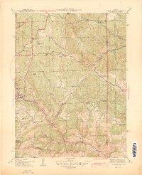
1944 Map of Black Hawk
USGS Topo · Published 1944About this map
The mining heritage of Gilpin County is deeply etched into this 1940s landscape, centered on the historic mountain settlements of Black Hawk and Central City. Surveyed during the war years, the map reveals a terrain defined by steep gulches and high peaks, where early industrial activity left a lasting mark on the land. Gold mining history is evident in named landmarks like Summit Mine and the many steep ravines such as Russell Gulch and Lake Gulch that fed into North Clear Creek.
Find a feature on this map
42 named features on this map. Tap any name to fly to it.
Don’t see what you’re looking for? This feature index may not catch every label — zoom into the map to look around manually.
Map Details
Editions of this 1944 Black Hawk Map
2 editions found

Other maps of this area

1899 · West Denver
USGS Topo · 1:125,000

1903 · Georgetown
USGS Topo · 1:62,500

1905 · Central City
USGS Topo · 1:62,500

1905 · Georgetown
USGS Topo · 1:62,500

1906 · Blackhawk
USGS Topo · 1:62,500

1910 · Central City
USGS Topo · 1:62,500

1912 · Central City
USGS Topo · 1:62,500

1942 · Eldorado Springs
USGS Topo · 1:24,000

1942 · Nederland
USGS Topo · 1:24,000

1942 · Central City
USGS Topo · 1:24,000