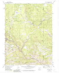
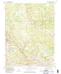
1972 Map of Black Hawk
USGS Topo · Published 1987About this map
Black Hawk anchors this 1970s survey, illustrating the intersection of historic Colorado mining legacies and emerging recreational lands. The landscape is marked by the heavy hand of 19th-century industry, from the Baltimore Mine and Honky Dory Mine to the extensive Dredge Tailings along North Clear Creek. These industrial remnants sit in contrast to the protected acreage of Golden Gate Canyon State Park and Roosevelt National Forest, which dominate the high ridges and gulches. The terrain is a network of named drainages like Silver Gulch and Chase Gulch, where early prospectors sought fortune. Genealogists and local historians can find specific landmarks such as the Cemetery near Dory Hill and numerous named summits including Tremont Mountain and Black Hawk Mountain. The map also reveals the shift toward modern outdoor use with features like Reverends Ridge Campground and Kriley Pond situated within the canyon road network.
Find a feature on this map
74 named features on this map. Tap any name to fly to it.
Don’t see what you’re looking for? This feature index may not catch every label — zoom into the map to look around manually.
Map Details
Editions of this 1972 Black Hawk Map
5 editions found
Other maps of this area

1899 · West Denver
USGS Topo · 1:125,000

1903 · Georgetown
USGS Topo · 1:62,500

1905 · Central City
USGS Topo · 1:62,500

1905 · Georgetown
USGS Topo · 1:62,500

1906 · Blackhawk
USGS Topo · 1:62,500

1910 · Central City
USGS Topo · 1:62,500

1912 · Central City
USGS Topo · 1:62,500

1942 · Eldorado Springs
USGS Topo · 1:24,000

1942 · Nederland
USGS Topo · 1:24,000

1942 · Central City
USGS Topo · 1:24,000