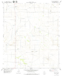
1979 Map of Black Hills
USGS Topo · Published 1979About this map
Moon Ranch and Maupin Ranch anchor this landscape in the Trans-Pecos region of Hudspeth County, reflecting the sparse, cattle-driven settlement patterns of West Texas in the late 1970s. The terrain is defined by the Black Hills, where water management is the primary human imprint on the land. A sophisticated network of catchment systems, including Horseshoe Tank, McGunnegle Tank, and Dishpan Tank, illustrates the essential infrastructure required for ranching in this arid environment. Beyond these isolated homesteads and livestock tanks, the map shows a quiet landscape of drainage features like Count Draw and localized industry at the Gravel Pit. This survey provides a precise look at the fencing, windmills, and tracks that supported remote ranching life before modern developments altered the high desert floor.
Find a feature on this map
15 named features on this map. Tap any name to fly to it.
Don’t see what you’re looking for? This feature index may not catch every label — zoom into the map to look around manually.
Map Details
Editions of this 1979 Black Hills Map
This is the sole edition of this map. No revisions or reprints were ever made.
Other maps of this area

1895 · Sierra Blanca
USGS Topo · 1:125,000

1948 · Triple Hill
USGS Topo · 1:62,500

1951 · Red Hills
USGS Topo · 1:62,500

1954 · Van Horn
USGS Topo · 1:250,000

1955 · Black Mountains
USGS Topo · 1:62,500

1958 · Van Horn
USGS Topo · 1:250,000

1973 · Norton Mesa
USGS Topo · 1:24,000
1973 · Movie Mountain
USGS Topo · 1:24,000
1979 · Pierce Ranch
USGS Topo · 1:24,000
1979 · Gunsight Hills South
USGS Topo · 1:24,000