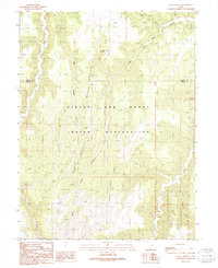
1991 Map of Black Knolls
USGS Topo · Published 1991About this map
The Uintah and Ouray Indian Reservation dominates this 1991 provisional survey of the high desert terrain along the boundary of Uintah and Grand Counties. The landscape is defined by a complex network of drainage systems, including the southward-reaching Upper Wagon Canyon and the winding Billie Brown Canyon. Prominent landforms such as the Black Knolls and the central Black Knoll rise above the deep cuts of Dry Gulch and Hill Creek. This territory shows little in the way of permanent modern infrastructure, instead emphasizing the natural geographic markers used for navigation and land management, such as Picket Corral Ridge and the water source at Upper Goat Spring. The map provides a look at the topographical character of the eastern Uinta Basin before the turn of the twenty-first century, tracing the ridges like Steer Ridge that separate the various canyon floors.
Find a feature on this map
15 named features on this map. Tap any name to fly to it.
Don’t see what you’re looking for? This feature index may not catch every label — zoom into the map to look around manually.
Map Details
Editions of this 1991 Black Knolls Map
This is the sole edition of this map. No revisions or reprints were ever made.
Other maps of this area

1885 · East Tavaputs
USGS Topo · 1:250,000

1953 · Firewater Canyon
USGS Topo · 1:62,500

1956 · Grand Junction
USGS Topo · 1:250,000

1959 · Grand Junction
USGS Topo · 1:250,000

1960 · Grand Junction
USGS Topo · 1:250,000

1962 · Grand Junction
USGS Topo · 1:250,000

1963 · Tenmile Canyon
USGS Topo · 1:62,500

1963 · Moonwater Point
USGS Topo · 1:62,500

1964 · Grand Junction
USGS Topo · 1:250,000

1965 · Grand Junction
USGS Topo · 1:250,000