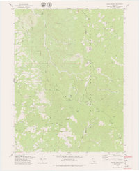
1979 Map of Black Lassic
USGS Topo · Published 1979About this map
Six Rivers National Forest dominates this California landscape along the rugged border of Humboldt and Trinity counties. The terrain is defined by a series of prominent peaks, most notably the triplet of Black Lassic, Mt Lassic, and Red Lassic, which overlook a network of high-elevation meadows and ridges. A sparse human presence is marked by primitive encampments and ranching outposts like Dutchman Camp, Fingal Ranch, and the curiously named Perry Salt Log.
Find a feature on this map
46 named features on this map. Tap any name to fly to it.
Don’t see what you’re looking for? This feature index may not catch every label — zoom into the map to look around manually.
Map Details
Editions of this 1979 Black Lassic Map
3 editions found
Other maps of this area

1918 · Anada
USGS Topo · 1:62,500

1920 · Harris
USGS Topo · 1:62,500

1921 · Hoaglin
USGS Topo · 1:62,500

1922 · Island Mountain
USGS Topo · 1:62,500

1931 · Hoaglin
USGS Topo · 1:96,000

1935 · Hoaglin
USGS Topo · 1:125,000

1949 · Blocksburg
USGS Topo · 1:62,500

1949 · Alderpoint
USGS Topo · 1:62,500

1951 · Alderpoint
USGS Topo · 1:62,500

1951 · Blocksburg
USGS Topo · 1:62,500