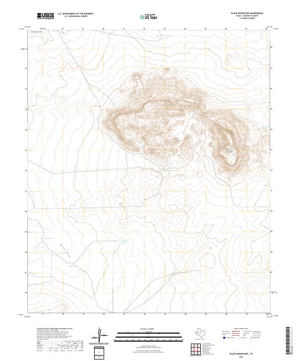
2022 Map of Black Mountains
USGS Topo · Published 2022About this map
The Black Mountains dominate this arid landscape in Hudspeth County, Texas, rising sharply above the surrounding desert floor. This 2022 survey reveals a terrain defined by hydraulic infrastructure essential for ranching and land management in the Far West Texas backcountry. A series of strategically placed water catchments, including Quatro Julio Tank, McAdoo Tank, and Black Mountain Tank, indicate the ongoing importance of water security in this Chihuahuan Desert environment.
Find a feature on this map
10 named features on this map. Tap any name to fly to it.
Don’t see what you’re looking for? This feature index may not catch every label — zoom into the map to look around manually.
Map Details
Editions of this 2022 Black Mountains Map
This is the sole edition of this map. No revisions or reprints were ever made.
Other maps of this area

1895 · Sierra Blanca
USGS Topo · 1:125,000

1948 · Triple Hill
USGS Topo · 1:62,500

1951 · Red Hills
USGS Topo · 1:62,500

1954 · Van Horn
USGS Topo · 1:250,000

1955 · Black Mountains
USGS Topo · 1:62,500

1958 · Van Horn
USGS Topo · 1:250,000

1973 · Norton Mesa
USGS Topo · 1:24,000

1973 · Sneed Mountain NE
USGS Topo · 1:24,000
1979 · Black Hills
USGS Topo · 1:24,000
1984 · Babb Canyon
USGS Topo · 1:24,000