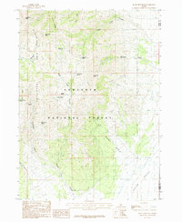
1985 Map of Black Pine Peak
USGS Topo · Published 1985About this map
Black Pine Mountains dominate this 1980s topographic landscape along the border of Cassia and Oneida Counties. This high-altitude terrain within the Sawtooth National Forest is characterized by a series of prominent summits, including Black Pine Peak and War Eagle Peak, which overlook a network of drainage systems like Black Pine Canyon and Kelsaw Canyon. The presence of several Prospect labels and a Mine Shaft in Mineral Gulch suggests a history of mineral exploration in the limestone and quartzite formations. Water sources are vital features in this arid environment, marked by numerous named springs such as Silver Hills Spring, Lost Tunnel Spring, and Pollard Spring. To the southeast, the terrain descends into the Burnt Basin and the wide expanse of the Curlew Valley, where the remains of an Abandoned Ditch indicate early efforts to manage water for grazing or local industry.
Find a feature on this map
30 named features on this map. Tap any name to fly to it.
Don’t see what you’re looking for? This feature index may not catch every label — zoom into the map to look around manually.
Map Details
Editions of this 1985 Black Pine Peak Map
This is the sole edition of this map. No revisions or reprints were ever made.
Other maps of this area

1954 · Pocatello
USGS Topo · 1:250,000

1954 · Brigham City
USGS Topo · 1:250,000

1958 · Pocatello
USGS Topo · 1:250,000

1958 · Brigham City
USGS Topo · 1:250,000

1959 · Strevell
USGS Topo · 1:62,500

1959 · Kelton Pass
USGS Topo · 1:62,500

1962 · Brigham City
USGS Topo · 1:250,000

1968 · Monument Peak NW
USGS Topo · 1:24,000

1973 · Juniper
USGS Topo · 1:24,000

1973 · Black Pine
USGS Topo · 1:24,000