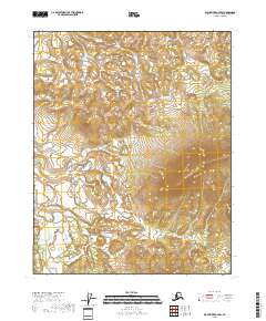
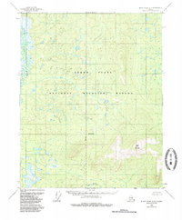
2018 Map of Black River A-4 SW
USGS Topo · Published 2018About this map
The interior of the Yukon-Koyukuk Census Area is meticulously charted in this topographic study, revealing a landscape dominated by complex drainage patterns and elevation changes. Bear Mountain Cr emerges in the southeastern corner of the quadrangle, serving as the primary named hydrological feature in this expanse of the eastern Alaska wilderness. The map details the precise township and range divisions, including t15n r23e and t14n r23e, which provide the essential spatial framework for land management and remote navigation in this unpopulated region. The intricate contour lines illustrate the high-relief terrain that characterizes the divide between various drainage basins, offering researchers a clear view of the natural geography before any modern human development.
Find a feature on this map
7 named features on this map. Tap any name to fly to it.
Don’t see what you’re looking for? This feature index may not catch every label — zoom into the map to look around manually.
Map Details
Editions of this 2018 Black River A-4 SW Map
This is the sole edition of this map. No revisions or reprints were ever made.
Other maps of this area

1951 · Charley River
USGS Topo · 1:250,000

1951 · Black River
USGS Topo · 1:250,000

1956 · Black River A-4
USGS Topo · 1:63,360
1956 · Black River A-5
USGS Topo · 1:63,360
1956 · Charley River D-4
USGS Topo · 1:63,360
1956 · Charley River D-5
USGS Topo · 1:63,360

1956 · Black River
USGS Topo · 1:250,000

1956 · Charley River
USGS Topo · 1:250,000

1964 · Black River
USGS Topo · 1:250,000
1984 · Black River A-4
USGS Topo · 1:63,360