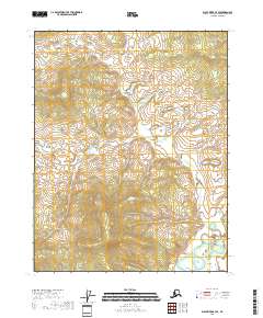
2018 Map of Black River B-3 SE
USGS Topo · Published 2018About this map
Grayling Fork Black River defines the lower-right reaches of this interior landscape, winding through a complex of wetlands and small ponds. This particular section of the Yukon-Koyukuk Census Area is characterized by a high-density network of small water bodies and seasonal basins, illustrating the saturated, low-lying drainage patterns typical of this sub-arctic environment. The terrain remains largely unpopulated, with no marked settlements, roads, or structures, leaving the topography and natural hydrography as the primary subjects of the survey. The mapping focuses on the township boundaries of t18n r26e, t18n r27e, t17n r26e, and t17n r27e, which provide the geometric framework for this remote wilderness area. For researchers or physical geographers, the map offers a precise record of the river's path and the surrounding marshland elevations before natural shifting or climate-driven changes alter the landscape.
Find a feature on this map
5 named features on this map. Tap any name to fly to it.
Don’t see what you’re looking for? This feature index may not catch every label — zoom into the map to look around manually.
Map Details
Editions of this 2018 Black River B-3 SE Map
This is the sole edition of this map. No revisions or reprints were ever made.
Other maps of this area

1951 · Black River
USGS Topo · 1:250,000

1956 · Black River A-2
USGS Topo · 1:63,360

1956 · Black River B-3
USGS Topo · 1:63,360

1956 · Black River B-2
USGS Topo · 1:63,360

1956 · Black River A-3
USGS Topo · 1:63,360

1956 · Black River
USGS Topo · 1:250,000

1964 · Black River
USGS Topo · 1:250,000
2018 · Black River B-3 NW
USGS Topo · 1:25,000
2018 · Black River B-3 NE
USGS Topo · 1:25,000
2018 · Black River B-3 SW
USGS Topo · 1:25,000