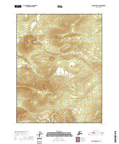
2018 Map of Black River D-3 NE
USGS Topo · Published 2018About this map
Rat Cr and David Cr provide the primary drainage for this interior stretch of the Yukon-Koyukuk region, winding through a landscape defined by sharp topographic relief. This 2018 survey, produced by the U.S. Geological Survey, maps the intricate contour intervals of the Black River D-3 NE area, where elevations reach up to 1,700 feet. The map is primarily structured by the Public Land Survey System, showing the intersections of four townships: T25n R25e, T25n R26e, T24n R25e, and T24n R26e. Without roads or established settlements, the map documents a purely natural environment as it appeared in the early 21st century. The reliance on remote sensing and the National Elevation Dataset provides a precise rendering of the ridges and valley floors that dictate the flow of the local creek systems.
Find a feature on this map
6 named features on this map. Tap any name to fly to it.
Don’t see what you’re looking for? This feature index may not catch every label — zoom into the map to look around manually.
Map Details
Editions of this 2018 Black River D-3 NE Map
This is the sole edition of this map. No revisions or reprints were ever made.
Other maps of this area

1951 · Black River
USGS Topo · 1:250,000

1951 · Coleen
USGS Topo · 1:250,000

1956 · Coleen
USGS Topo · 1:250,000

1956 · Black River D-3
USGS Topo · 1:63,360

1956 · Coleen A-3
USGS Topo · 1:63,360

1956 · Black River D-2
USGS Topo · 1:63,360

1956 · Coleen A-2
USGS Topo · 1:63,360

1956 · Black River
USGS Topo · 1:250,000

1964 · Black River
USGS Topo · 1:250,000
2018 · Black River D-2 SW
USGS Topo · 1:25,000