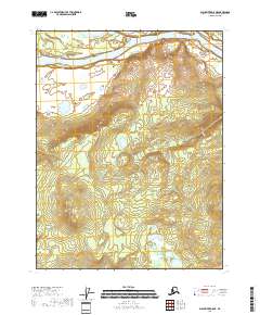
2018 Map of Black River D-5 NE
USGS Topo · Published 2018About this map
The Porcupine River flows across the northern reaches of this landscape in the Yukon-Koyukuk region. This terrain is characterized by the prominent elevation of Deacons Rock, which overlooks the river valley from the north bank. The map documents the vast, undeveloped character of the Alaskan interior, primarily organized through the Public Land Survey System grids including t25n r21e and t24n r21e. The absence of roads or established settlements emphasizes the isolation of this river corridor, where the natural course of the water remains the primary geographic feature of note.
Find a feature on this map
7 named features on this map. Tap any name to fly to it.
Don’t see what you’re looking for? This feature index may not catch every label — zoom into the map to look around manually.
Map Details
Editions of this 2018 Black River D-5 NE Map
This is the sole edition of this map. No revisions or reprints were ever made.
Other maps of this area

1951 · Black River
USGS Topo · 1:250,000

1951 · Coleen
USGS Topo · 1:250,000

1956 · Coleen
USGS Topo · 1:250,000

1956 · Coleen A-5
USGS Topo · 1:63,360

1956 · Black River D-4
USGS Topo · 1:63,360

1956 · Black River D-5
USGS Topo · 1:63,360

1956 · Coleen A-4
USGS Topo · 1:63,360

1956 · Black River
USGS Topo · 1:250,000

1964 · Black River
USGS Topo · 1:250,000
2018 · Black River D-4 SW
USGS Topo · 1:25,000