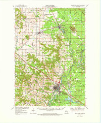
1968 Map of Black River Falls
USGS Topo · Published 1971About this map
The Black River winds through central Wisconsin, anchoring a landscape where the river economy and glacial topography meet. This late 1960s survey documents the convergence of the Chicago and North Western railroad with significant recreational and forestry tracts, including the Black River State Forest and Castle Mound Recreation Area. Near the southern edge, the Winnebago Mission and Decorah Cem represent important cultural landmarks, while the agricultural surrounding areas are dotted with local touchstones like Cloverdale School and West Garden Valley Ch. The region's unique geography is defined by prominent elevations such as Silver Mound and Stanley Mound, which rise above the intricate network of coulees and creeks. Evidence of the local timber and bog industries remains visible through features like the Cranberry Bogs near Sheppard and various Gravel Pits that supported the area's development.
Find a feature on this map
95 named features on this map. Tap any name to fly to it.
Don’t see what you’re looking for? This feature index may not catch every label — zoom into the map to look around manually.
Map Details
Editions of this 1968 Black River Falls Map
This is the sole edition of this map. No revisions or reprints were ever made.
Other maps of this area

1924 · Black River Falls
USGS Topo · 1:62,500

1926 · Black River Falls
USGS Topo · 1:62,500

1926 · North Bend
USGS Topo · 1:62,500

1927 · Blair
USGS Topo · 1:62,500

1928 · Melrose
USGS Topo · 1:48,000

1929 · North Bend
USGS Topo · 1:62,500

1935 · Osseo
USGS Topo · 1:48,000

1940 · Osseo
USGS Topo · 1:62,500

1947 · Millston
USGS Topo · 1:62,500

1948 · Fairchild
USGS Topo · 1:62,500