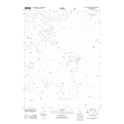
2012 Map of Black Rock Mountain
USGS Topo · Published 2012About this map
Payne sits at the northern edge of this high-elevation terrain, where the drainage of the E Fork S Fork Trinity River meets Wild Mad Rd. This landscape is defined by a dense network of ridges and gulches, including Buck Ridge, Powell Ridge, and Raspberry Gulch, which historically served as remote outposts for forestry and recreation. The mapping of multiple cabins and campsites, such as Blossom Cabin, Jensen Cabin, and Bearwallow Camp, points to a long-standing pattern of seasonal occupation and backcountry management in the Trinity County wilderness. Significant geological landmarks like Black Rock Mountain and the distinctively named Tombstone Rock anchor the topography. To the south, the terrain transitions into the watershed of the N Fork Middle Fork Eel River, illustrating the complex divide between these major Northern California river systems.
Find a feature on this map
33 named features on this map. Tap any name to fly to it.
Don’t see what you’re looking for? This feature index may not catch every label — zoom into the map to look around manually.
Map Details
Editions of this 2012 Black Rock Mountain Map
This is the sole edition of this map. No revisions or reprints were ever made.
Other maps of this area

1890 · Red Bluff
USGS Topo · 1:250,000

1894 · Red Bluff
USGS Topo · 1:250,000

1931 · Hoaglin
USGS Topo · 1:96,000

1935 · Hoaglin
USGS Topo · 1:125,000

1951 · Chanchelulla Peak
USGS Topo · 1:62,500

1953 · Blackrock Mtn
USGS Topo · 1:62,500

1954 · Dubakella Mtn
USGS Topo · 1:62,500

1954 · Blackrock Mtn
USGS Topo · 1:62,500

1954 · Yolla Bolly
USGS Topo · 1:62,500

1958 · Redding
USGS Topo · 1:250,000